Self Drive Tours
YOUR COMPLETE GUIDE TO DISCOVER THE MAGIC OF THE FITZGERALD COAST
DAY 1 ARRIVE IN RAVENSTHORPE
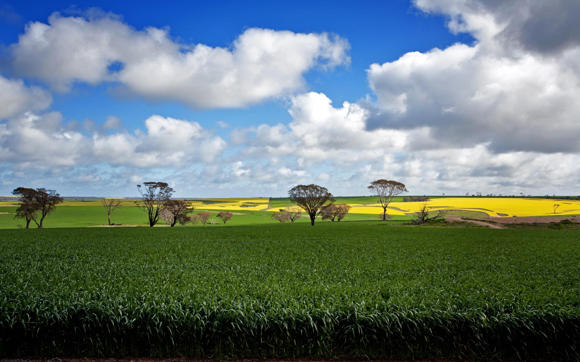
Weave through agricultural land taking in the view of rolling hillsides, natural bushland and fields of yellow canola (when in season) as you arrive into Ravensthorpe.
DAY 2 RAVENSTHORPE
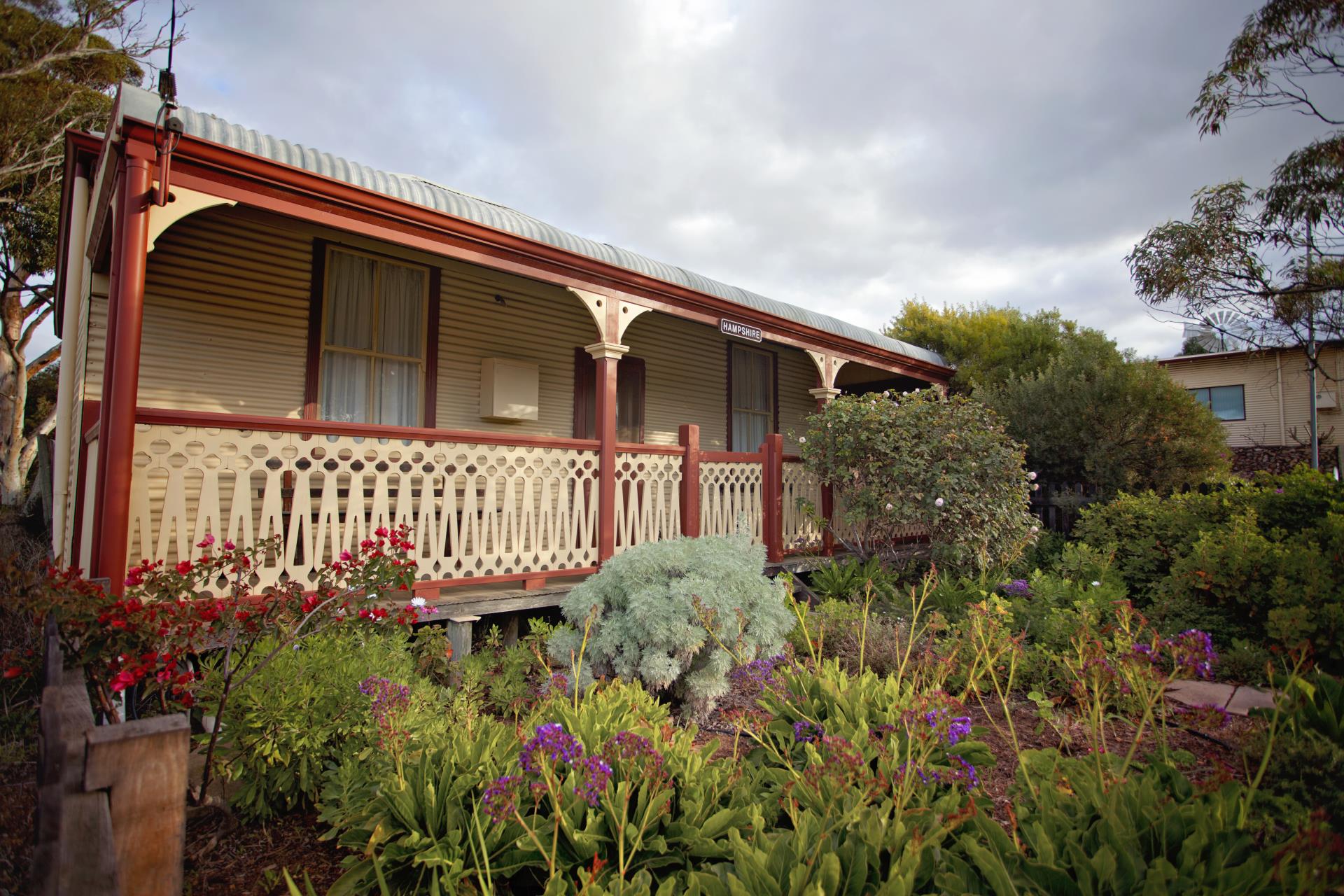
Enjoy breakfast at one of the local cafes, each boasting great coffee and homemade goodies, prior to heading to the Ravensthorpe Museum. Get lost amongst displays of locally made produce, arts and crafts, and the history of our region. This museum is a hidden gem, the volunteers are so knowledgeable you will love spending your morning here.
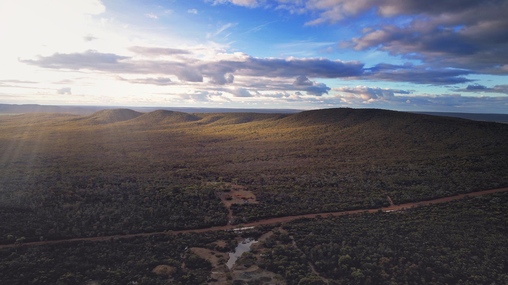
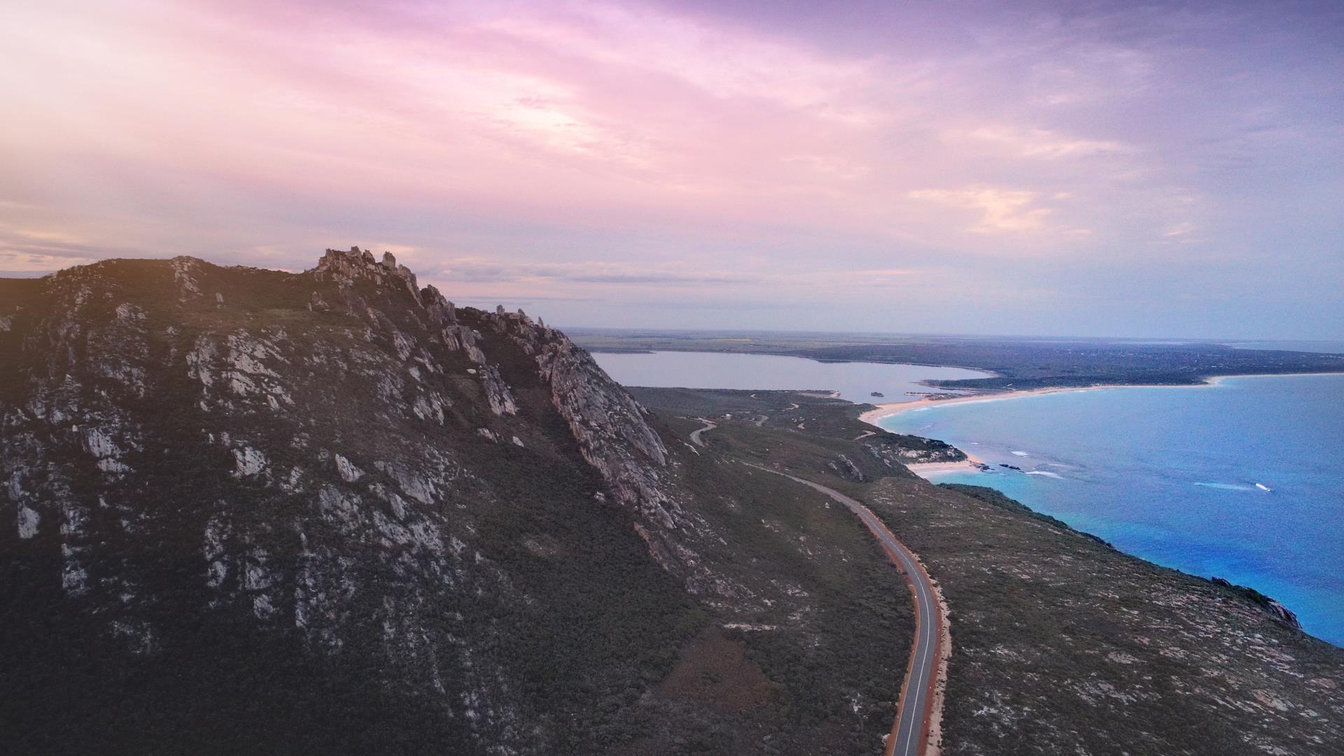
Head for the Hills! This 4WD tour takes you on a 29 km journey along the top ridge of the Ravensthorpe Range. The range has the most Eucalyptus species in the world for its size and is exploding with wildflowers and mining history. Reset your odometer at the Museum and follow the Ravensthorpe Range Scenic 4WD Tour: Travel east down Morgans Street from the Museum towards the roundabout, turning left at the roundabout onto the heavy haulage route. Continue past Hosking Street turning right onto Floater Road (Second Right). ‘Lookout’ signposted.
| DISTANCE |
DIRECTIONS |
| 4.4km |
On the left is Galaxy Resources lithium mine. Sorry no entry. |
| 6km |
You are now approaching the old Floater Mine site on the left, operations began in 1899. |
| 10km |
Immediately after turning a sharp corner to the left turn right and ascend Archer Drive. Depending on the season and time of the year you will see many wildflowers such as, Nodding Banksias, Beaufortias, Lechenaultias, Bottlebrushes, Verticordias and Qualup bells. |
| 11km |
Archer Drive Lookout. Have a break and take in the secenery. View from left to right: Mt Desmond, Elverdton copper mine headframe and tailings dam, East Mt Barren, Eyre Range, Ravensthorpe town (easily distinguished by the three large grain silos). Spend time exploring the range. |
| 21km |
Clearing.Turn left and follow the “to Carlingup Road’ sign. Cockies Tongues, (Templetonia retusa), Red Pea Flowers. |
| 22km |
Carlingup Road, turn right. |
| 23.5km |
South Coast Highway, turn right for Ravensthorpe. |
DAY 3 RAVENSTHORPE TO HOPETOUN
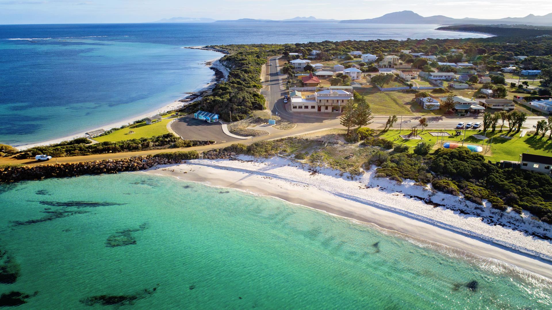
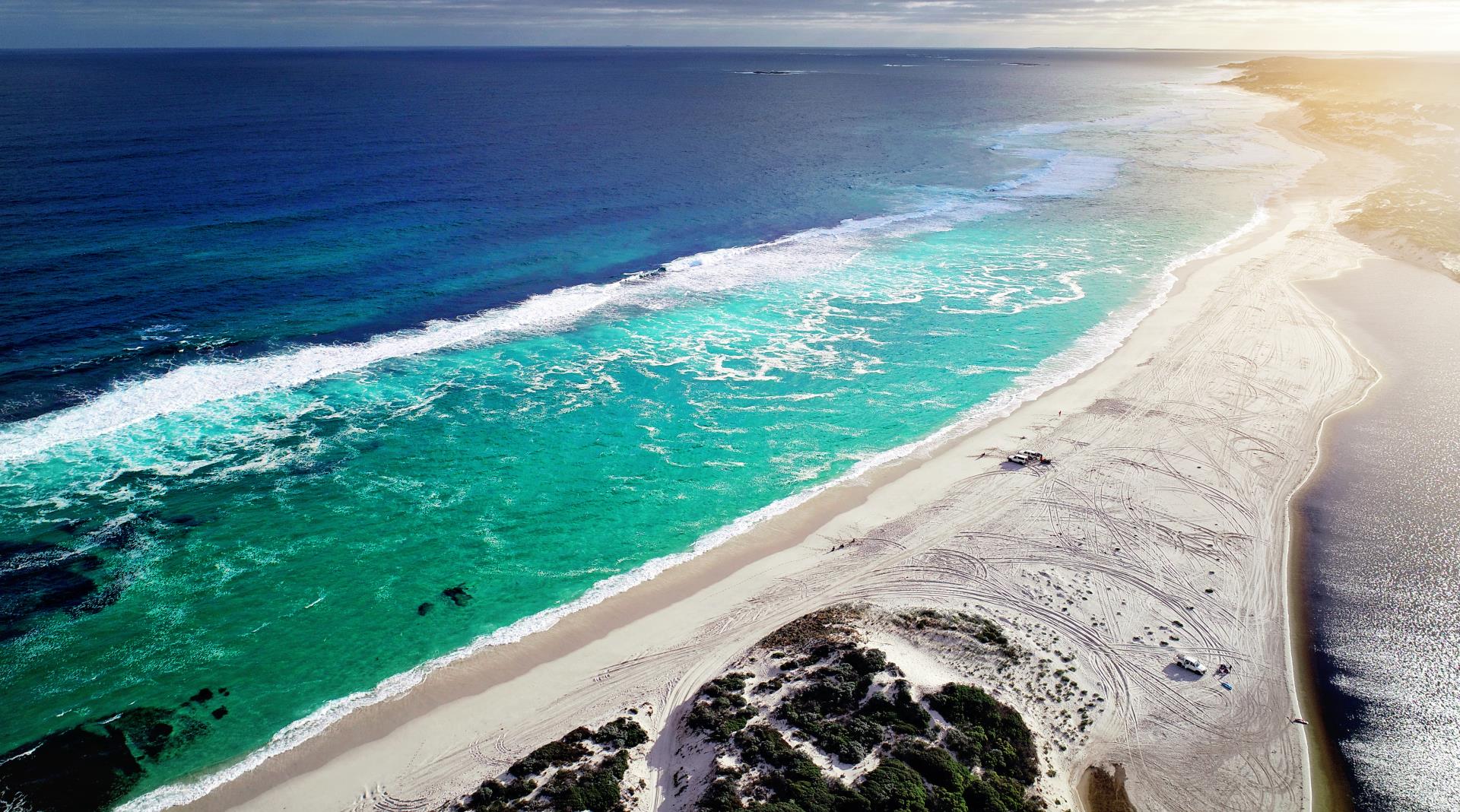
Make your way to Hopetoun, stopping in at the historical Kundip information bay, where a bustling town once thrived during the gold rush era. Enjoy the crops to your left and right as you get closer to Hopetoun, safely pull over to the side of the road and get a snap of the very impressive crops from July – September. Check in to your accommodation and have the afternoon at leisure. Stroll around the shops at the beautiful seaside town of Hopetoun. Get your feet wet and throw a line in the crystal clear water or just kick back and rest. Make your way down to the Groyne at sunset and join the locals in a ‘Groyney’.
DAY 4 HOPETOUN & FITZGERALD RIVER NATIONAL PARK
The Fitzgerald River National Park is one of the largest and most botanically significant national parks in Australia. Year round access is only a few kilometres from Hopetoun, just before the first roundabout into town turn right onto Hamersley Drive. You will discover mountains and spectacular coastlines, viewing platforms, wildflowers and wildlife. Make sure you have your camera at the ready and you may want to add an extra day or two if you want to take advantage of everything that the park has to offer!
Climb East Mt Barren is a must do, take a short walk to East Mylies' Beach, check out the ocean views from the Cave Point Lookout, walk the world class Hakea Trail to the breathtaking Quoin Head. Keep a watch for whales during June to October. Have some fun 4WDing and exploring the Hamersley sand dunes or paddle a canoe on the inlet. Remember to check Parks and Wildlife's road condition report (Click here for report) if you plan to head out on the tracks and unsealed roads as they may be closed at short notice due to wet weather to help prevent the spread of dieback through this pristine part of Western Australia. During dry conditions, if you're not towing a caravan you can do the Hamersley Drive Trail by accessing the National Park from South Coast Highway on the unsealed Hamersley Drive North (approximately 46.5km) which adjoins the sealed Hamersley Drive South near Hamersley Inlet and continues on to Hopetoun. It is important to note for your own safety that caravans are not permitted on unsealed roads within the Park as the roads are narrow and may be quite corrugated.
DAY 5 MUNGLINUP
Head to Munglinup via Springdale Rd, turning right at Munglinup Beach Road. (Around 85 km) or the scenic Southern Ocean Rd route (check road conditions as unsealed section can become corrugated) which will take you past Masons Bay and Starvation Bay ideal spots for swimming and fishing. If you're not in a hurry, why not stay a bit longer in one of the campgrounds located at each Bay?
Once in Munglinup, relax under the shady trees, take a walk along the beach, snorkel the pristine waterways or kayak the Oldfield Estuary.
RAVENSTHORPE SCENIC DRIVES
Mt Madden Scenic Drive - 160km Round Trip
| DISTANCE |
DIRECTIONS |
| Start |
Leave from the Ravensthorpe Museum and proceed west through the main street. If you haven't already, be sure to stop in at the grain silos as you pass to admire the Banksia Mural. Continue on South Coast Highway |
| After 3.6km |
turn right onto Lake King Road |
| 10 km |
On your right there is a Rest Area, it is encouraged you pull in to see old mining relics. Mt Short is on the right (highest peak in the Ravensthorpe Range). Many wildflowers can be spotted in this rest area. |
| 23 km |
Rest Area on left. Pincushion hakea trees flower in autumn and winter. For the next few kilometres, you will see Banksias, Blue Mallees, Rock Oaks, Tea Trees and Bottlebrushes. |
| 4.37km |
On the left you will see the Mt Madden bin. The grain from these bins is then transferred to the Esperance Port. Farmland on this drive, in some cases dates back to early 20th century, however a large proportion has been developed since 1966 |
| 5.50km |
Pallarup Rocks Nature Reserve. Turn right off the sealed road to a shady rest area with an Information Bay, picnic tables and bush walks.Turn right at the freshwater standpipe to the historic well, there is a 16 km walk to Mt Madden which was developed by the Lake King Primary School for the 1988 Bicentenary. In spring an abundance of wildflowers can be found on this walk. Return to the sealed road and after 50m on your left there is a track to Lake Pallarup which will take you on a circular drive around the lake. (check the conditions of the road before proceeding). Allen road will take you back to the sealed Lake King Rd. |
| 74km |
Turn left onto Muncasters Rd (gravel), watch out for a plaque detailing the history of the CBH site. |
| 80km |
Turn left onto Hatters Hill Rd, on the left is a plaque marking the site of the first Mt Madden School, turning right onto Mt Madden Rd and make your way to Mt Madden Rock. Explore the rock, great picnic spot at the bottom. |
| Return |
To travel back to Ravensthorpe - return to Hatters Hill Rd, turning left at Muncaster Rd, turn right at Stennets Lake Rd, right at Beatty Rd, turning left onto Lake King Rd at 124 km. |
Mt Short Scenic Drive - 40km
| Start |
Depart from the museum, heading west and turn right onto the Lake King Rd. |
| 18.4km |
Turn right onto Mt Short Road (gravel 4WD is recommended in wet weather). You will see a gravel pit on your right and an access sign to climb Mt Short, the highest peak in the Ravensthorpe Range, measuring at 448m- allow one hour up a rough path to reach the top. Continue driving on Mt Short Rd through the range. |
| 25km |
Turn right onto Floater Rd. From here you can view Archer Drive Lookout or follow Floater Rd back onto the heavy haulage route and into Ravensthorpe. |
| Ravensthorpe |
Depart Ravensthorpe Museum, head towards Esperance along the South Coast Highway.On the left near the caravan park, is the location of the old railway station 1909- 1935. |
| 6.6km |
No.1 Smelter (1904) ruins can be seen on the hill to the left – private property, no entry. |
| 13km |
Turn right at the Elverdton Road sign onto gravel road. |
| 16.7km |
Turn right, Ethel Daw Lookout has panoramic views over farmland, natural bush, Elverdton and Desmond copper mines and Southern Ocean. If entering into the bush beware of old mine shafts. Return down Ethel Daw Drive and turn right at the end – continue up Elverdton Road. Going down the hill you will observe Pincushion hakeas flowering profusely in autumn and early winter. |
| 19.1km |
Turn left onto the Ravensthorpe Hopetoun Road (sealed) to observe the old Elverdton copper mine and gold processing plant finally closed in 1990. STRICTLY NO ADMITTANCE. Nothing remains of the old Desmond town site west of the road. TURN AROUND and now head back to Ravensthorpe |
| 24.8km |
No sign, but you can take a spur to the right (0.7kms along the track which is rough and will require 4WD in wet weather) and you will see the expansive ruins covering about 20 hectares of the No.2 Smelter, where gold, copper and silver ore were extracted from 1906 to 1918. More details available at the Museum. Return to the sealed road and turn right to head back to Ravensthorpe. |